Mount Prevost
295ft2designationa
WIND DIRECTION |  |
LAUNCH48.83089° N, 123.76783° W LANDING ZONE48.81136N,-123.75136W | |
REQUIRED* SITE RATING | P2 or H2 |
WING TYPESParaglider | SITE TYPECross Country
|
| *HAGAR required above 3000′ as per Airspace regulations. | |
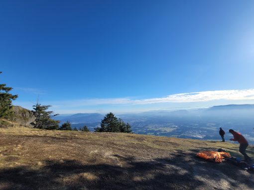
About: Mount Prevost is the most often flown and also the best beginner friendly site on Vancouver Island. It provides flying opportunities throughout the year.
Hazards: Be aware that outflow winds (north and east) can create dangerous rotor. Prevailing N wind can sometimes appear as what seems like S cycles on E and Main launch, if there is any north wind in the forcast beware! Also make sure you have enough glide to clear the ridge when heading east, if in doubt just head for the LZ! Finally, be aware of the powerlines as well as airspace limits.
Launch Access: 2WD.
The access road is well maintained but it is gated and usually locked mid summer due to fire risk. We have keys which you can access by emailing island@westcoastsoaringclub.com or via our WCSC (Vancouver Isl and Saltspring) WhatsApp chat. There is also a lovely hiking trail on the west side of the mountain that starts on Drinkwater Road.
Launch Descriptions:
The main launch faces south and is new P2/H2 friendly. It is best flown in a S or SW wind. Sometimes on stronger thermic days the thermal activity will overpower light winds from other directions and create ideal launch conditions in other winds despite the forecast. If you aren’t sure, ask for help!
East launch is a small cliff launch with little room for error and should only be flown with experienced local pilots as there can be issues with rotor and leeside in certain weather conditions. Best flown in SE or E winds, any N component makes it particularily dangerous.
West launch is typically used for soaring flights and evening glass offs. Although it has a large easy setup area the cliff below it can create challenging takeoff conditions for beginners along with a long glide back to the LZ. Works in SW, W, or NW winds.
LZ: The LZ is a large field off the Cowichan highway across from Duncan Meadows golf club. Checking it out before flying is strongly recommended as there are high voltage power lines running parallel to the highway and another set at the base of the mountain. This is private property! Please respect it and avoid blocking the gate or trampling more grass than necessary when it is getting tall as this is an active hay field.
Site Regulations: Our agreements with the regional district and the owners of the LZ require:
-Current HPAC membership.
-Current WCSC membership.
-A District of North Cowichan waiver on file. You can download the waiver here:
https://tinyurl.com/ywaxpeb9
Please scan your completed waiver and email it to
island@westcoastsoaringclub.com
Gate Key:
During fire season the road to launch is gated. We have been provided with two keys that we can use to access the site.
Rules for key use:
– Post in the group chat that you are taking a key up the hill. The key is now your responsbility.
– If you are giving the key to someone else to drive down the hill post who you have given it to and make sure that person understands it is now their responsibliy to return it.
– Post again when returning the key to the box that it has been returned.
Airspace: Airspace on the southern part of Vancouver Island is complicated!!!
Please take the time to understand the airspace at the site before flying here or ask a mentor for help. https://airspace.canadarasp.com/
Pilots without HAGAR can fly Prevost up to a maximum altitude of 3000’. These airspaces NEED to be respected as Westjet could be on approach to Victoria airport right overhead and they will not be looking for you.
Radio Frequency:
Club: 144.500 or 146.415 MHz
Aircraft: 123.025(Duncan CYA), 122.800(Duncan aerodromes), 119.100(Victoria outer tower), 127.800(Victoria terminal), 126.700(en route freq)
Flying Season:
Prevost is flyable almost all year. Usually the launch is snow free by early march, and good flights have been recorded as late as mid November and as early as mid February. Spring time bring strong lift and can be more challenging for new pilots, whereas July through September tend to be more relaxed while still strong enough for reliable thermal flying.
House Thermals:
On SW or S wind days the house thermal tends to be either infront of main launch or infront of the rocky cliffs just west of main launch.
On SE or E wind days the house thermal is usually infront of “the cairn” which is the peak just east of east launch. Be cautious heading east into wind right off launch as it’s possible to have trouble clearing the flat area of trees to get out front heading in that direction. Most tree landings in the history of prevost flying have been people trying this in the wrong conditions. The Cairn can also be soared on stronger wind days and can be more easily accessed when taking off from east launch.
Another house thermal tends to form half way between launch and the LZ on the knob where the ridge rolls over. Look for a partially grown in clearing as the trigger point on south days or surf up the east side of the ridge on east days.
Cross Country:
XC options are limited and challenging due to airspace, but Prevost tends to get great convergence conditions which can make big moves possible on the right day. Ask a local for advice!

Emergency Situations
Radio Frequency: 144.500 or 146.415 MHz
Emergency: 911
In the event of an incident, one person at the scene should take charge and delegate a single individual to contact Emergency Services.
All press enquiries should be referred to the Club President or Safety Officer. DO NOT speak to the press directly. Privacy laws prohibit the release of member details without permission.
Discover More Flying Sites