Beaufort Valley

designationa
WIND DIRECTION |  |
LAUNCH49.345663°, LANDING ZONE49.309491°, | |
REQUIRED* SITE RATING | P2 or H2 |
WING TYPESParaglider | SITE TYPECross Country |
*HAGAR required because of Airspace regulations. | |
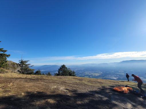
The Beaufort Valley offers some of the best flying on the island for experienced XC pilots capable of independent, self-guided flying adventures.
Although site requirements may appear restrictive at first glance, they represent the bare minimum to reflect the complex nature of this site. Notably, accessing launch by car requires passing through private land with active logging operations.
Does this seem daunting? Fear not! We encourage pilots to enjoy this amazing site and dedicated volunteers are happy to help.
Novice pilots should fly with a mentor. Don’t have one? Sign up here! Experienced Pilots are encouraged to join as well.
This site has special requirements due to its location on private land with active logging operations, and proximity to the Port Alberni Airport and Class E airspace. Please respect these requirements to ensure our collective continued access, safety, and allow us to negotiate improvements in the near future!
Required:
- Current HPAC insurance
- P2 rating or above
- HAGAR certification for flight in Class E Airspace, (per: Canadian Aviation Regulations)
- Current WCSC membership/visitor status (per: Land Access Agreement)
- Gate key for road access via approved route (contact Lars below)
Strongly Recommended(!)
- Airband radio and restricted aeronautical operators license for at least one pilot per group
- Inreach/Spot (registered to XCFIND)
- Tree kit
- Bivy/overnight survival kit
Advisory
- This is Class E airspace above 700’ AGL and there is NO CYA(H/S) in the valley
- The existing glider advisory on VNCs (general aviation charts) should NOT be confused with a
CYA as it does not change airspace structure/class or legal requirements
Safety:
- Busy airspace! Sail planes, recreational, commercial, and forestry aircraft are very common.
- Most commercial traffic between Mt Irwin and Loon Lake. Some N or Mt Hal.
- Strong valley winds and cloud suck especially late in afternoon.
- Monitor real time wind data at PA harbour for webcam (http://www.bigwavedave.ca/webcams.php?cam=11 )
- Gated logging roads make for challenging retrieves if you fly north beyond the last fields.
Pre-flight arrangements:
- We have permission to fly every weekend or holiday until March 2021.
- Request NOTAM with Kamloops FIR Number: (250 376 6278) on the day you intend to fly.
- Call Sailplane club (1-866-590-7627) and notify them that you will be flying.
- Pick up key (Contact Lars below).
*Members are responsible for safety of the key and will be charged a $500 key replacement cost if key is misplaced.
Local ridge soaring ROW rules:
-Standard ROW rules from CARs apply.
-Local ridge soaring rules apply to PG/HG/Sailplane pilots.
-International ridge soaring rules are used in the Beaufort valley: the pilot with the ridge to the right has right of way, while the pilot with the ridge to the left must yield and give right of way by turning away from the ridge.
Altimeter setting:
– Approximate sea level pressure can be found at BWD under “Alberni HQ”: http://www.bigwavedave.ca/latest.php
Cross-Country:
– XC potential along ridgelidge and out over valley.
-Be aware that the logging roads to the NW of the last fields and to the SE under Arrowsmith are gated so be prepared to hike out; landing options among cut blocks are limited.
-Strong inflow late in the day can make the return trip south from beyond Mt. Cameron challenging.
Flying Season:
-Best XC season is in the spring and early summer; flyable until mid to late September.
Flight logs:
Please post your flights to your flight database of choice: XContest/PG Forum Leonardo etc. More useage helps us with future negotiations for better access.
Locations:
Launch: (49.345663°, -124.832381°)
Loon Lake Gate access to launch: (49.250609°, -124.701821°)
Launch Parking: 49.346404°, -124.834733° (approximate)
Main LZ: Brian and Lisa’s Farm on Granville Rd: (49.309491°, -124.845411°)
-If you leave a vehicle here, park in their driveway and not on the side of road.
Location of key: See contact for Lars below.
Launch Access:
-See attached road maps. Follow Loon Lake main to Macmillan main and appropriate branch roads as marked.
-Gate is locked; key must be obtained from local pilot.
-Use road frequency posted at Loon Lake gate while on logging roads. Announce:
“Empty pick-up at (X) km on (road name eg. Loon main)” on the way up, and “Loaded pick up at X km on (road name eg. Loon main)” on the way down.
-Launch and road access is on private property.
-Please drive safely, respect private property and equipment, stay on designated access route, lock gate behind you and keep key safe.
-As we only have one set of keys, a good option is to leave third vehicle parked at loon gate and store key here.
-Only WCSC/ISS parties are permitted to access site: please do not let anyone else in behind the gate.
-The launch is located about 200m to the SE from the parking area. At the time of writing, there is no trail to launch. Hike 5 min to the SE through well-spaced tree plantations to reach the launch site. There is no wind-sock so bring some flagging tape with you.
Launch Description:
The Mt Irwin “Deer Hunter’s” launch is located in the saddle SE of Mt Irwin proper. The launch itself has a large, flat grass-covered area that has space to accommodate about two fully laid out wings. There is a natural rock launch-ramp which slopes nicely downhill towards the valley providing a relatively safe and non-committing launch and still offering good clearance over some soft, 20 year-old saplings below. The site faces prevailing meteorological winds (from the SW) which help coax thermic cycles up to launch from the valley below. House thermals are found above the wide-open bowl below launch, the spines immediately to the SE and NW, as well as directly above launch.
LZs:
As above.
Airspace:
Class E Comox TCA 700ft to FL 23000. HAGAR required. Glass G below 700ft.
Hike and Fly:
There are also a number of lovely unofficial hike and fly options in the area, please get in contact with a local pilot through the WCSC whatsapp if interested.
Radio Frequencies:
VHF club frequency: 146.415 MHz. Use for PG chatter.
Aerodrome Traffic Frequency: 123.0 MHz. Use for position reports, comms with other non-PG aircraft.
Radio protocol:
- PG related chatter will take place club frequency (146.415 MHz) as per usual.
- At least 1 airband radio is strongly recommended per group.
- The pilot carrying the airband should monitor the ATF (123.0 MHz) for the group and relay info via club frequency to other PG pilots who are not on ATF.
- On the ATF, keep transmissions succinct and to the point; minimize chatter. No PG related chatter on this channel.
- Immediately prior to launch, announce your plans on the ATF to launch from the Mt Irwin PG launch site.
- Monitor ATF during day.
- Position report every 30 min.
- Use ft ASL for elevation and NMs from airport for distances. (See reference landmark distances below.)
- Alternatively, simply use place names (Eg Mt Joan for locations) but ensure you know approximate distances to interpret other gliders position reports.
- Report on ATF when last PG pilot has landed safe and flights have concluded of the day or call sailplane club.
Reference landmarks:
- These quick reference distances are provided in NMs from the airport.
- Launch: 4 NM ENE of airport.
- SE end of ridge near gold course: 6 NMs E of airport
- Mt Joan 6 NMs N of airport
- Mt Apps: 7.5 NMs N from airport.
ATF radio protocol:
- Your call sign is “Paraglider” followed by your initials in phonetic alphabet. Eg. BB = “Paraglider Bravo Bravo”.
Prior to launch:
- “Alberni traffic, this is Paraglider Bravo Bravo preparing to launch from Mt Irwin Ridge at 3500 ft, 4 nautical miles ENE of airport with (X number) of other pilots.
Position reports every 30 minutes:
- “Alberni traffic, Paraglider Bravo Bravo 6300′ over Mt Hal 4 miles NE off the airport with 3 other paragliders. Any conflict please advise.”
Sailplanes transmissions:
- Sailplanes pilots will typically do a position report every 15 minutes if there has been no one reporting in their area.
-Position report would be
- ” Alberni Traffic, glider Delta Zulu Victor 7 miles to the east of airport at 6500′ circling. Any conflicting traffic please advise ”
-If no conflict anticipated, advise:
- “This is Paraglider Bravo Bravo, no conflict anticipated” or alternatively, no response would be sufficient.
-Or if conflict anticipated, advise:
- “Glider Delta Sulu Victor, this is Paraglider Bravo Bravo, we are in your immediate vicinity 5 miles east of airport at 6000 ft. I have you on visual. We are leaving the area, we are flying to NW back towards Mt Irwin.”
Commercial/recreational aircraft transmissions:
You may hear from a commercial aircraft like Pacific Coastal transiting to Tofino from Vancouver:
- ” Pascol 146 14 miles east of the port Alberni airport transiting to Tofino at 4500′ any conflicting traffic please advise.”
- Respond in similar fashion as above.
Post flight:
After all PGs are on the ground:
- “Alberni traffic, this is PG Bravo Bravo, all PGs have landed safely and we have finished flying for the day.”
- If no response, kindly give the sailplane club a call and let them know.
Primary Contacts:
Lars: 250 735 4521

Beaufort Valley Guide
Click to download a site guide in PDF format

Beaufort Valley Airspace
Class E Comox TCA 700ft to FL 23000. HAGAR required. Glass G below 700ft.

Beaufort Valley Site Records
Hang Gliding
- Please send
Paragliding
- Please send

Emergency Situations
Radio Frequency: 146.415 MHz
Emergency: 911
In the event of an incident, one person at the scene should take charge and delegate a single individual to contact Emergency Services.
All press enquiries should be referred to the Club President or Safety Officer. DO NOT speak to the press directly. Privacy laws prohibit the release of member details without permission.
Discover More Flying Sites